Introduction:
In the realm of Android applications, the diversity and usefulness of programs continue to expand, enriching our daily lives. Among these, Avia Maps Aeronautical Charts stands out as a remarkable example, offering a specialized service for aviation enthusiasts. Developed by Remy Webservices UG and available on Google Play, this application brings aviation mapping to the fingertips of users, providing a unique experience tailored to pilots and aviation aficionados.
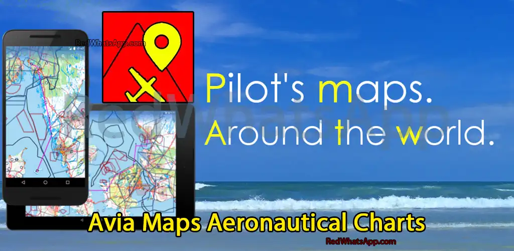
What is Avia Maps Aeronautical Charts?
Avia Maps Aeronautical Charts is a specialized aviation map application designed for Android smartphones. Unlike traditional mapping applications, Avia Maps caters to the specific needs of pilots and aviation enthusiasts by offering detailed aviation maps encompassing over 50 thousand airports worldwide. Developed by Remy Webservices UG, this app provides accurate airspace delineations for more than 42 different countries, making it a comprehensive tool for flight planning and navigation.
Features:
- Access to Aviation Maps of Over 42 Different Countries: Avia Maps provides access to detailed aviation maps covering more than 42 countries worldwide. This extensive coverage ensures that pilots have the necessary information for flight planning regardless of their location.
- High Detail Maps with Proprietary Markings: The maps offered by Avia Maps are highly detailed and include proprietary markings relevant to aviation. These markings aid pilots in navigation and ensure precise flight planning.
- Calculate Fuel Requirements for Safe Flight: One of the key features of Avia Maps is its ability to calculate the amount of fuel needed for a safe flight. By factoring in various parameters such as distance, aircraft specifications, and weather conditions, the app helps pilots make informed decisions regarding fuel requirements.
- Avia Weather Integration for Accurate Calculations: Avia Maps integrates with Avia Weather service to provide real-time weather information relevant to flight planning. By incorporating weather data into calculations, the app ensures accuracy and enhances safety during flight operations.
- Observation of Air Borders: Users can observe the air borders of different countries using Avia Maps. This feature enables pilots to navigate airspace boundaries and comply with international aviation regulations seamlessly.
- Offline Map Usage: Avia Maps allows users to download maps for offline usage, ensuring accessibility even in areas with limited connectivity. Pilots can pre-download maps of their desired regions and access them anytime, anywhere, without relying on an internet connection.
- Display of Over 50 Thousand Airports Worldwide: With Avia Maps, users can access information on more than 50 thousand airports worldwide. This extensive database of airports facilitates flight planning and navigation, providing pilots with essential information for their journeys.

Pros:
- Comprehensive Aviation Maps: Avia Maps Aeronautical Charts offers detailed aviation maps covering over 62 countries worldwide, including major aviation hubs like the United States, Canada, Europe, Australia, and New Zealand.
- Extensive Database: With over 65,000 airports, 9,000 navaids, and 15,000 waypoints, Avia Maps provides pilots with essential navigation points for flight planning and in-flight navigation.
- Offline Availability: Users can download relevant data for offline use, allowing access to maps and essential information even in areas with limited or no internet connectivity.
- Global Weather Forecasts: The app integrates global, high-resolution weather forecasts from reputable sources such as the German DWD and US American NOAA, offering accurate weather map layers for cloud cover, ceiling, precipitation, and wind.
- Terrain Overlay: Avia Maps includes a digital elevation model that dynamically colors hills and mountains on the map based on the user’s current altitude, enhancing situational awareness during flight, particularly in mountainous regions.
- Traffic Information Integration: The app can display traffic information from ADS-B receivers or the SafeSky app directly on the map, enhancing safety by providing real-time traffic awareness to pilots.
- Aircraft Profile Customization: Users can create multiple aircraft profiles based on handbook values for climb performance, fuel consumption, and other parameters, allowing for accurate performance calculations tailored to specific aircraft types.
- Synchronization Across Devices: Avia Maps enables synchronization of routes, aircraft profiles, and user waypoints across multiple devices, ensuring continuity and convenience for users who access the app on different platforms.
Cons:
- Limited Trial Period: While Avia Maps offers a trial period with full features, users are required to purchase a perpetual license or subscribe to the professional tier after the evaluation period of 30 days, which may deter some users.

FAQ (Frequently Asked Questions):
- Is Avia Maps Aeronautical Charts available for free? Avia Maps offers a trial app with full features. However, after a 30-day evaluation period, users will need to purchase a perpetual license from within the app or subscribe to the professional tier for continued access.
- Can I use Avia Maps offline? Yes, Avia Maps allows users to download relevant data for offline use, enabling access to maps and essential information without requiring an internet connection.
- How accurate are the weather forecasts provided by Avia Maps? Avia Maps integrates global, high-resolution weather forecasts from reputable sources such as the German DWD and US American NOAA, ensuring accuracy and reliability in weather information.
- Does Avia Maps support synchronization across multiple devices? Yes, Avia Maps enables synchronization of routes, aircraft profiles, and user waypoints between multiple devices, providing convenience and continuity for users who access the app on different platforms.

Installation Guide for Avia Maps Aeronautical Charts:
- Download from Google Play Store:
- Visit the Google Play Store on your Android smartphone.
- Search for “Avia Maps Aeronautical Charts” developed by Remy Webservices UG.
- Tap on the app icon to open its page.
- Click on the “Install” button to download and install the app on your device.
- Download from Website:
- Alternatively, you can visit the official website of Avia Maps Aeronautical Charts, or any authorized distributor.
- Locate the download link for the Android version of the app.
- Click on the download link to initiate the download process.
- Once the download is complete, locate the downloaded APK file in your device’s file manager.
- Enable Installation from Unknown Sources:
- Before installing the app from the APK file, ensure that your device allows installations from unknown sources.
- Go to your device’s settings.
- Navigate to the “Security” or “Privacy” settings.
- Enable the option for “Unknown Sources” to allow installations from sources other than the Google Play Store.
- Install the App:
- Once you’ve enabled installations from unknown sources, locate the downloaded APK file in your device’s file manager.
- Tap on the APK file to initiate the installation process.
- Follow the on-screen instructions to complete the installation of Avia Maps Aeronautical Charts on your device.
- Launch the App:
- Once the installation is complete, locate the Avia Maps Aeronautical Charts icon on your device’s home screen or app drawer.
- Tap on the icon to launch the app.
- Permissions:
- Upon launching the app for the first time, it may prompt you to grant certain permissions such as access to your location, storage, and network.
- Allow the necessary permissions to ensure the smooth functioning of the app.
- Explore and Enjoy:
- You’re now ready to explore the features and capabilities of Avia Maps Aeronautical Charts.
- Start by familiarizing yourself with the interface and accessing the various aviation maps and tools provided by the app.
- Enjoy using Avia Maps Aeronautical Charts for pre-flight planning and in-flight navigation.
- Optional Account Creation:
- While not mandatory, you may have the option to create an account within the app for additional features such as synchronization across multiple devices.
- Follow the on-screen prompts to create an account if desired.
- Update Regularly:
- To ensure optimal performance and access to the latest features, it’s recommended to keep Avia Maps Aeronautical Charts updated.
- Check for updates regularly either through the Google Play Store or within the app itself.
- Troubleshooting:
- If you encounter any issues during installation or while using the app, refer to the app’s documentation or support resources for troubleshooting assistance.
Final Words:
In conclusion, Avia Maps Aeronautical Charts offers a unique and invaluable resource for pilots and aviation enthusiasts. Developed by Remy Webservices UG and available on Google Play, this application provides access to detailed aviation maps, weather information, and essential flight planning tools. With features such as offline map usage, proprietary markings, and accurate fuel calculations, Avia Maps stands as a comprehensive solution for aviation navigation needs. Whether for professional pilots or hobbyists, Avia Maps Aeronautical Charts remains a must-have tool for safe and efficient flight operations.